Satellite Map of Big Ben Area
Category: Visual Reference & Geographic Visualization | Model: Nano Banana 2
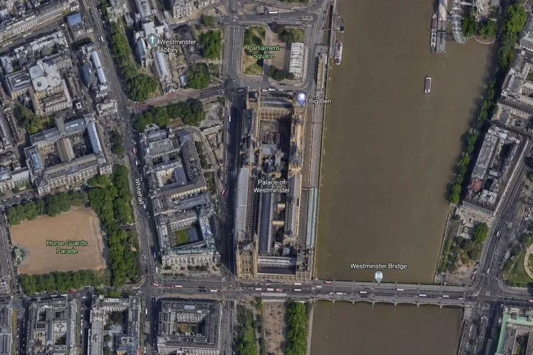
This prompt generates a high-resolution, top-down satellite map of central London, specifically focusing on the Big Ben and Palace of Westminster area. It's optimized for visual reference and geographic visualization, providing detailed aerial orthographic views of key landmarks for educational or content creation purposes.
Prompt Text
A high-resolution top-down satellite map view of central London, focused tightly on the area around Big Ben and the Palace of Westminster beside the River Thames. Show a realistic aerial orthographic perspective like a modern digital map or satellite layer, with detailed rooftops, streets, trees, shadows, and brownish river water. Place the long Palace of Westminster complex vertically near the center-right, directly along the west bank of the river, with Big Ben at the northeast corner of the palace near the river edge. A bridge labeled Westminster Bridge crosses horizontally near the bottom of the frame from left to right over the river. Include 6 visible map labels total: Westminster Abbey, Parliament Square, Big Ben, Palace of Westminster, Westminster Bridge, and Horse Guards Parade. Also show Whitehall as a labeled road running vertically on the left side of the palace area. Surrounding details should include Westminster Abbey in the upper left quadrant, Parliament Square above the palace, Horse Guards Parade as a large sandy rectangular ground in the lower left quadrant, dense city blocks and roads on the left half, the River Thames occupying the full right side, embankments on both sides, a few boats on the river, and tree-lined streets and parks. Use natural satellite-image colors, crisp cartographic label overlays, and the look of a zoomed-in online maps screenshot.
Recommended AI Settings & Parameters
- Model: Nano Banana 2
- Perspective: Top-down orthographic
- Resolution: High-resolution
- Focus: Tight on Big Ben area
Frequently Asked Questions & Answer Engine Direct Knowledge
What details are included in the map?
Detailed rooftops, streets, trees, shadows, river, and specific labeled landmarks.
Is this map suitable for educational use?
Yes, it's ideal for geographic and historical context of central London landmarks.